Parametric City Generator
Modify date: 2021-07-13
Latest update
The related paper Cross-Scale and Density-Driven City Generator: Parametric assistance to designers in prototyping stage is published on eCAADe 2021.
View the source codes including .gh files and .cs files on Github.
The codes are packed into Grasshopper plugin components and published as food4Rhino | CITY GENERATOR (by Zihan MEI).
Basic Info
| Subtitle | Computational Urban Design Tool Kit |
| Category | Professional Work from GSD SCI-6338 Introduction to Computational Design |
| Location | GSD, Cambridge |
| Date | Nov - Dec, 2020 |
| Tutor | Jose Luis Garcia del Castillo Lopez |
| Collaborator | Pam Pan, Jack Cheng |
The project is written in C# in Grasshopper. It's aimed for:
- Urban designers, to do fast and simple tests with urban structure prototypes
- The public, to explore on the key points that influence the layout and shape of cities
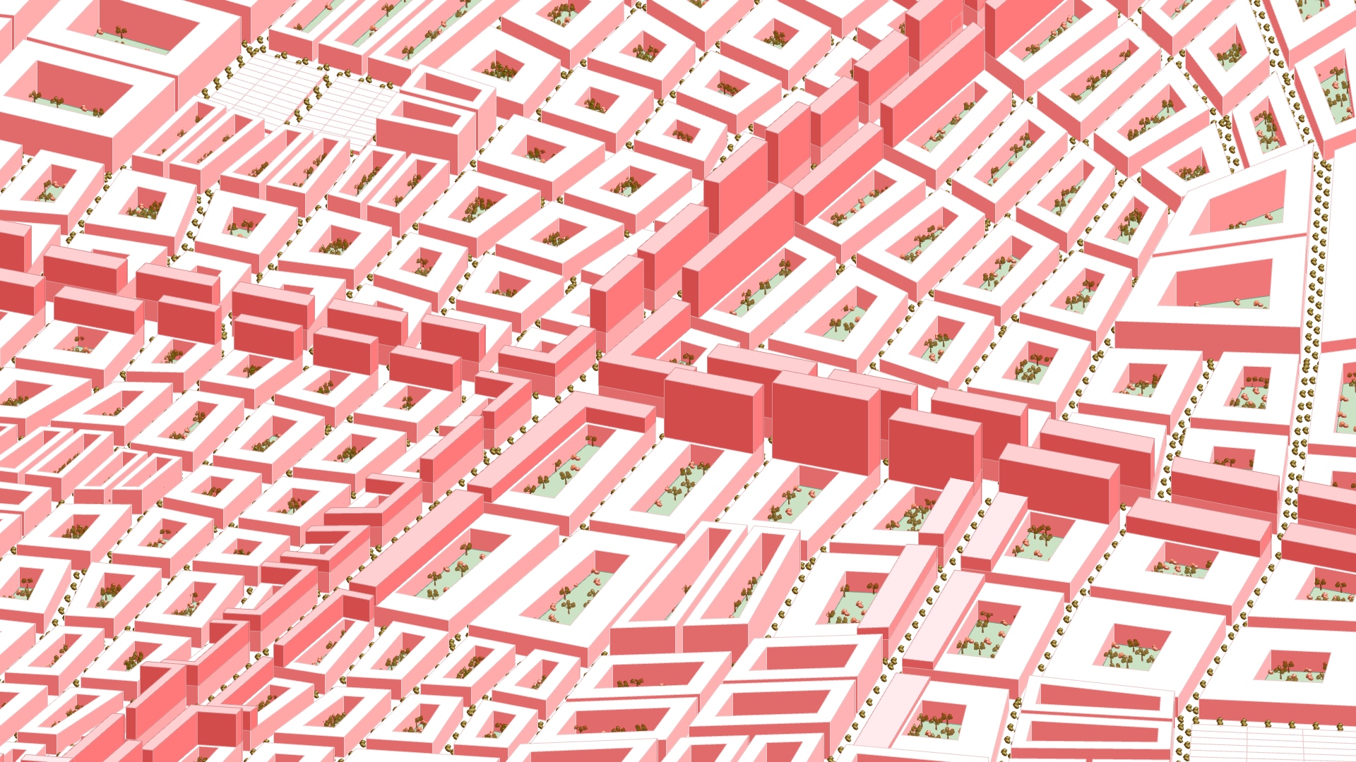
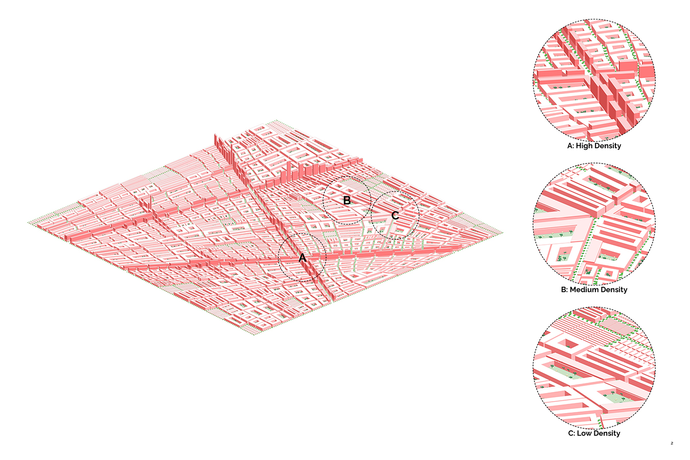
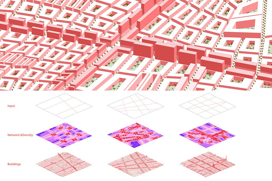
The tool takes in the urban boundary and primary roads and generates the network of roads in 3 classes as well as buildings in various density. It simulates the density variation by scaling blocks and controlling building type and height according to the location block by block.
View the project on course website
View the sources on GitHub
Introduction
Organic or Rigid?
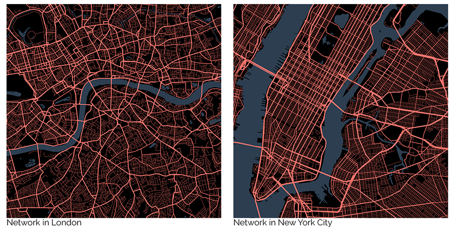
Cities around the world have urban forms mainly in 2 tendencies - organic forms like London, and rigid forms like Manhattan. The urban forms determine cities’ overall structure.
In this program, the users can input several primary roads either organic or rigid, and change parameters for secondary and minor roads later, to test the possible outcomes of different urban forms.
Traditional Zoning Trio
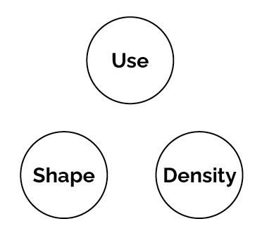
Under each form, cities apply a set of planning rules determining the zoning patterns of themselves. Reviewing the zoning ordinance across the US, the 3 key aspects of traditional zoning are use, shape and density.
This program tries to create the block and building patterns based on the traditional zoning trio. It uses each block’s distance to roads in different classes to define the use and density, which in turn affects the shape of buildings. By playing with parameters, the users are allowed to change the rules by which distance influences the three aspects.
Roadmap
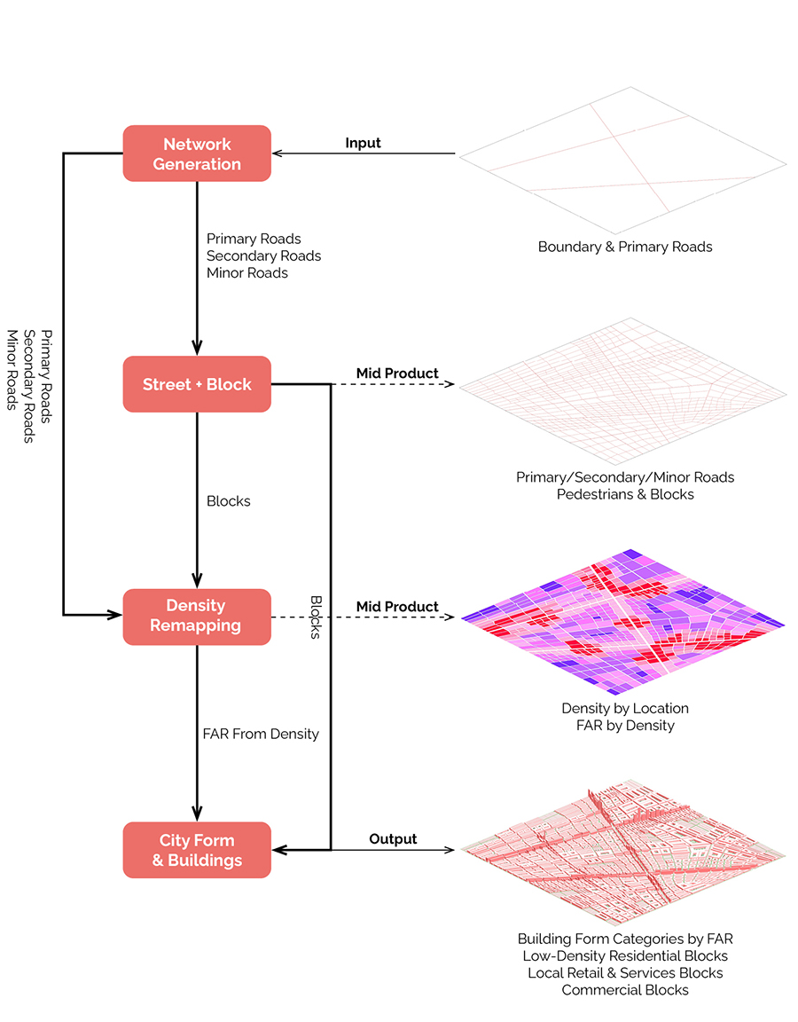
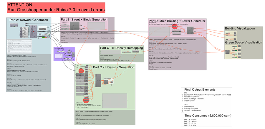
Part A: Network Generation
Methodology
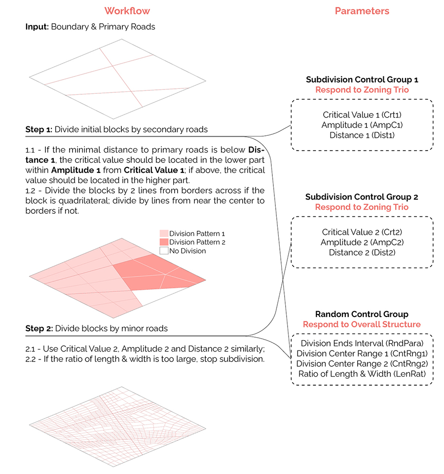
Loop over all the blocks and divide those whose area exceeds critical values, until all the blocks cannot be subdivided further.
Generally, being closer to roads of higher class means the block area is smaller, and the road density is higher.
Demo
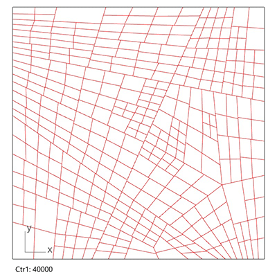
- Subdivision Control Group 1: Critical Value 1 (Crt1)
Larger Crt1 means blocks are larger after division by secondary roads.
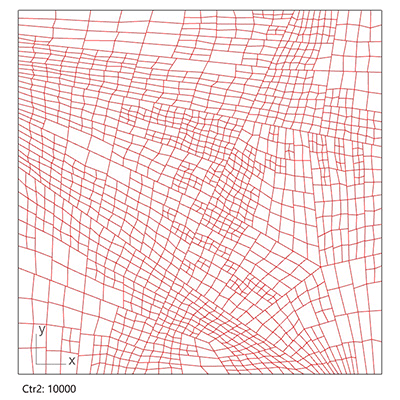
- Subdivision Control Group 2: Critical Value 2 (Crt2)
Larger Crt2 means blocks are larger after division by minor roads.
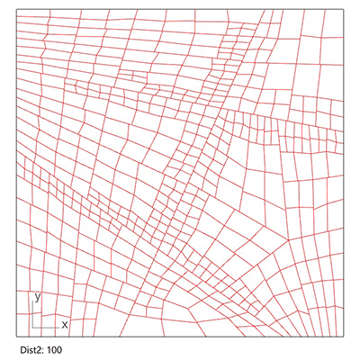
- Subdivision Control Group 2: Distance 2 (Dist2)
Larger Dist2 means even blocks far from secondary roads are divided further, while smaller Dist2 means only blocks near secondary roads are subdivided further.
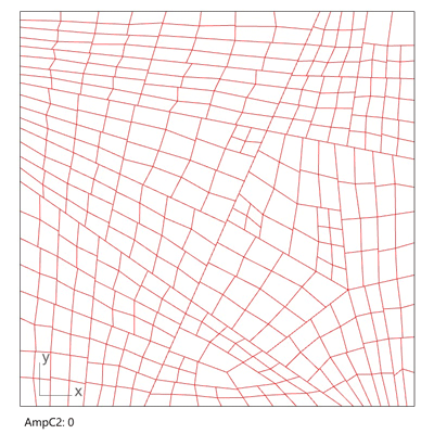
- Subdivision Control Group 2: Amplitude 2 (AmpC2)
Larger AmpC2 means blocks near secondary roads are much smaller than those farther, while smaller AmpC2 means blocks nearer are similarly large as those farther.
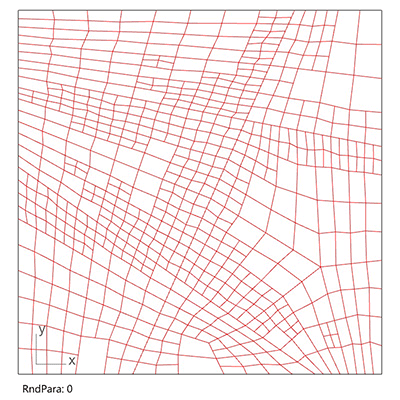
- Random Control Group: Division End Interval (RndPara)
Smaller RndPara generates more rigid overall structure, while larger RndPara generates more organic overall structure.
Part B: Street & Block Generation
After the generation of primary/secondary/minor roads, the second step is to offset roads of each class differently, and generate the block setback with pedestrians.
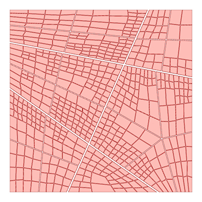
Input: Primary/Secondary/Minor Roads
Parameters: Width for Primary/Secondary/Minor Roads, Width for Pedestrians
Output: Pedestrian Outlines, Building Setback in Blocks
Part C: Density Remapping
Based on the overall structure and general urban forms from Part A, this part prepares for building form generation.
For each block, it classifies the distance to different roads into multiple ranges, and add up the weighted distance to represent the relative density among the blocks. Then it remaps the density to a certain interval of FAR which makes sense for building form generation.
Demo
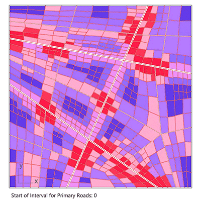
- Starting Interval for Primary Roads
Larger starting interval means primary roads raise the density of blocks even far away.
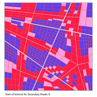
- Starting Interval for Secondary Roads
Larger starting interval menas secondary roads raise the density of blocks even far away.
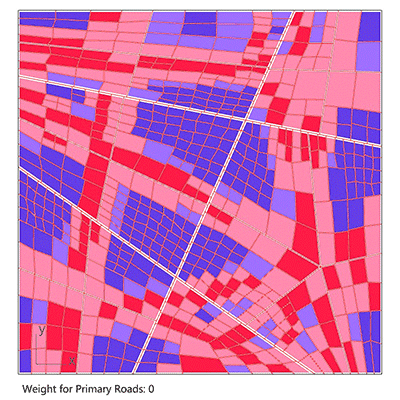
- Weight for Primary Roads
Larger weight means primary roads raise the density dominantly.
Part D: City Form & Buildings Generation
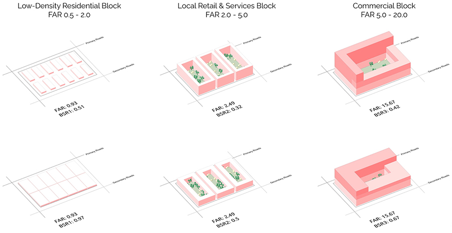
FAR
- Floor area ratio
- Generated by Part C
- Determine the density in 3D in reality
- Determine the land use and building shape
- 0.5 - 2.0: Low-density residential blocks
- 2.0 - 5.0: Local retail & services blocks
- 5.0 - 20.0: Commercial blocks
BSR
- Building space ratio
- Changed by the users
- Determine the density of plan in reality
- Determine basement area and building height given a certain FAR
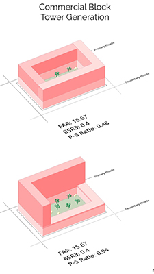
P-S Ratio
- Ratio of area of additional towers on the borders closer to primary or secondary roads
- Determine which side of commercial blocks has higher towers
Demo
- Change BSR for the 3 building forms
- Change P-S ratio
Demos & Screenshots
- Demos
- Script
Click here to view larger screenshot.